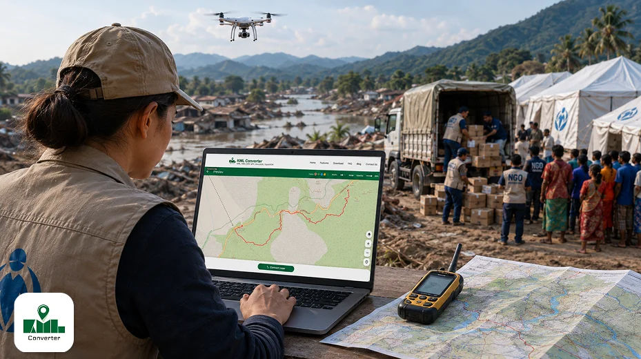
When a sudden flash flood submerges entire districts in South Asia, or a severe earthquake collapses vital infrastructure in the Middle East, every second matters. In complex crises, the biggest barrier to saving lives isn't a lack of supplies it is a lack of clear, real-time spatial information. Aid agencies cannot deliver food, medical supplies, or clean water if they do not know where survivors are located or which access routes remain passable.
This is where Geographic Information Systems (GIS) have transformed modern relief operations. By turning raw geospatial data into dynamic, interactive maps, GIS technology empowers non-governmental organisations (NGOs) to make rapid, life-saving decisions.
Below is an in-depth exploration of how international NGOs use GIS mapping to plan aid, allocate scarce resources, and optimise emergency relief worldwide.
What is GIS Mapping in Humanitarian Aid?
Geographic Information System (GIS) mapping in humanitarian aid is the process of collecting, analysing, and visualising spatial and geographic data to support disaster management, emergency relief, and long-term development operations.
Instead of relying on static paper maps, humanitarian GIS combines layers of geographic information such as population density, road networks, terrain elevations, medical facility locations, and flood risk zones into a single visual dashboard.
By connecting physical location to critical demographic and operational data, GIS allows field commanders and headquarters teams to quickly identify where needs are greatest and how to reach affected populations safely.
5 Ways International NGOs Use GIS Mapping for Faster Relief
1. Rapid Damage Assessment After Sudden Disasters
When earthquakes or hurricanes strike, immediate field reconnaissance is often impossible due to blocked roads or destroyed telecommunications. International NGOs rely on satellite mapping for humanitarian aid and high-resolution aerial imagery from drones to assess damage remotely.
By overlaying pre-disaster satellite imagery with post-disaster scans, GIS tools perform automated change detection. Relief agencies can instantly identify:
-
Destroyed bridges and impassable roads.
-
Flattened residential zones and makeshift displacement camps.
-
Operational versus damaged healthcare facilities.
This immediate clarity prevents rescue teams from wasting critical hours sending supply convoys down impassable routes.
2. Strategic Resource Allocation and Supply Chain Logistics
Humanitarian logistics is notoriously complex. When aid supplies arrive at regional hubs, NGOs must decide how to distribute limited stockpiles across dozens of remote communities.
GIS resource allocation for NGOs helps solve this puzzle by calculating optimal transit routes, predicting fuel requirements, and mapping pre-positioned distribution hubs. For instance, during cholera outbreaks or severe flooding, spatial analysis identifies water points contaminated by runoff, allowing NGOs like Doctors Without Borders (MSF) or Direct Relief to deploy mobile water purification units and oral rehydration stations directly to high-risk clusters.
| Operational Challenge | How GIS Solves It | Key Benefit |
| Blocked Supply Lines | Integrates satellite imagery to map passable alternative roads. | Saves critical travel time for supply convoys. |
| Unequal Aid Distribution | Tracks real-time delivery locations against population heat maps. | Eliminates aid duplications and blind spots. |
| Disease Outbreaks | Overlays health facility data with water source contamination maps. | Enables rapid targeted medical intervention. |
| Staff Safety Concerns | Monitors active conflict zones and hazard perimeters in real time. | Reduces security risks for field responders. |
3. Early Warning and Proactive Disaster Preparedness
Modern disaster management with GIS mapping isn't just reactive it is preventative. Through predictive modelling, international NGOs combine historical climate data, river basin levels, and topographic maps to forecast natural hazards before they happen.
If severe weather sensors indicate rising river levels, GIS models run flood inundation simulations to predict which villages will submerge within 48 to 72 hours. NGOs can pre-position emergency rations, issue targeted evacuations, and alert vulnerable communities long before the first wave hits.
4. Real-Time Field Team Tracking and Mobile Data Collection
Field workers operating in crisis zones use mobile GIS applications such as ArcGIS Survey123 or KoboToolbox to collect structured data directly from their smartphones or tablets, even when offline.
As field workers survey shelter needs, record medical cases, or verify clean water access, the geo-tagged entries sync automatically to a central dashboard once network connectivity returns. Decision-makers at headquarters gain a continuous, live view of conditions on the ground without waiting days for manual paper reports to be transcribed.
5. Enhancing Transparency and Donor Communication
Donors, governments, and the public demand strict accountability for where humanitarian funds go. GIS mapping offers unprecedented transparency by converting complex operational metrics into accessible visual stories.
NGOs use interactive web maps and spatial dashboards such as ArcGIS StoryMaps to show donors exactly where medical kits were delivered, where water wells were dug, and how many displaced families were sheltered in specific sectors.
Commonly Used GIS Tools in the Humanitarian Sector
International agencies and local response teams leverage a mix of enterprise platforms, open-source software, and crowdsourced mapping tools:
-
Esri ArcGIS: The industry standard for enterprise GIS, offering specialised tools for spatial analysis, dynamic dashboards, and mobile field collection.
-
QGIS: A powerful, free, open-source GIS application widely adopted by smaller regional NGOs and field analysts operating under tight budget constraints.
-
Humanitarian OpenStreetMap Team (HOT): A global community of volunteer mappers who convert satellite images into free, detailed geographic maps of unmapped disaster zones.
-
UNOSAT (UN Operational Satellite Applications Programme): Provides satellite imagery analysis and geographic reports during major humanitarian crises worldwide.
-
MapAction: A specialised international NGO dedicated exclusively to deploying GIS experts directly to emergency disaster sites to provide mapping support for incoming responders.
Key Benefits of GIS Technology for Humanitarian Organisations
Why has location intelligence become an essential capability for modern relief agencies? The core benefits include:
-
Faster Response Times: Automated spatial analysis reduces emergency response planning from days to a matter of hours.
-
Cost-Effective Operations: Route optimisation cuts vehicle maintenance, fuel costs, and supply chain bottlenecks.
-
Data-Driven Prioritisation: Ensures aid reaches isolated or marginalised communities that might otherwise be overlooked.
-
Improved Inter-Agency Coordination: Shared web maps prevent different NGOs from duplicating efforts in the same neighbourhood while leaving adjacent areas without support.
-
Worker Safety: Real-time risk mapping keeps field personnel away from active flood zones, unstable structures, or unsafe roads.
Final Thoughts: The Future of Humanitarian GIS
In emergency management, geography dictates outcomes. As climate change causes more frequent extreme weather events and geopolitical crises become more complex, the role of location intelligence in international aid will only grow.
By combining real-time satellite imagery, artificial intelligence, and mobile data collection, GIS mapping empowers international NGOs to move faster, allocate resources smarter, and ultimately save more lives.