Introduction
Five years ago, setting up precision agriculture on a mixed 2,000-acre operation meant spending days manually driving property perimeters in a side-by-side, logging GPS waypoints into proprietary monitor formats that rarely talked to each other. If you switched tractor brands or updated your FMIS (Farm Management Information System), half your boundary data ended up corrupted or misaligned.
Today, the entire landscape has shifted toward interoperable spatial data. At the centre of this shift is Keyhole Markup Language, better known as a KML file. By rendering precise geographical boundaries, elevation points, and field zones into lightweight code, KML files have become the universal translator for farm machinery, surveying drones, and agronomy software.
Whether you manage wheat fields in Kansas, corn rows in Iowa, sugarcane in Queensland, or vineyards in the Western Cape, understanding how farmers are using KML files to map fields is one of the fastest, lowest-cost steps you can take toward full digital efficiency.
What is a KML file in agriculture?
A KML (Keyhole Markup Language) file stores geographic data like property lines, soil management zones, and drainage routes as XML code. Farmers use KML files to import field boundaries into tractors, sprayers, drones, and mapping apps like Google Earth or QGIS without losing location accuracy.
What Is a KML File in Agriculture?
A KML file is an XML-based file format used to display geographic data in Earth browsers such as Google Earth, mobile mapping apps, and modern farm management terminals. Originally created by Keyhole Inc. (which Google acquired in 2004), KML holds vector data including lines, polygons, points, and embedded attributes like crop history, acreage calculations, and soil type labels.
When compressed into a single archive file, it takes the KMZ extension. In agricultural practice, KMZ and KML are used interchangeably, with KMZ serving as the preferred format when attaching custom icons, image overlays, or multiple field boundaries into a single file transfer.
Why Modern Farms Rely on KML Mapping
Modern equipment runs on spatial coordination. When a boom sprayer enters a field, the section-control computer must know precisely where the boundary lies to prevent spraying over waterways or applying chemicals across property lines.
KML files solve three major challenges in farm tech:
-
Cross-brand compatibility: John Deere, Climate FieldView, Raven, Trimble, and Case IH hardware all accept or convert KML/KMZ files easily.
-
Zero licensing costs: Unlike proprietary spatial software formats, KML is an open standard maintained by the Open Geospatial Consortium (OGC). You can view and edit files using completely free software.
-
Portability: Files are lightweight enough to text to a custom applicator or email to an agronomist directly from a smartphone in the field.
Key Use Cases: How KML Files Drive Daily Operations
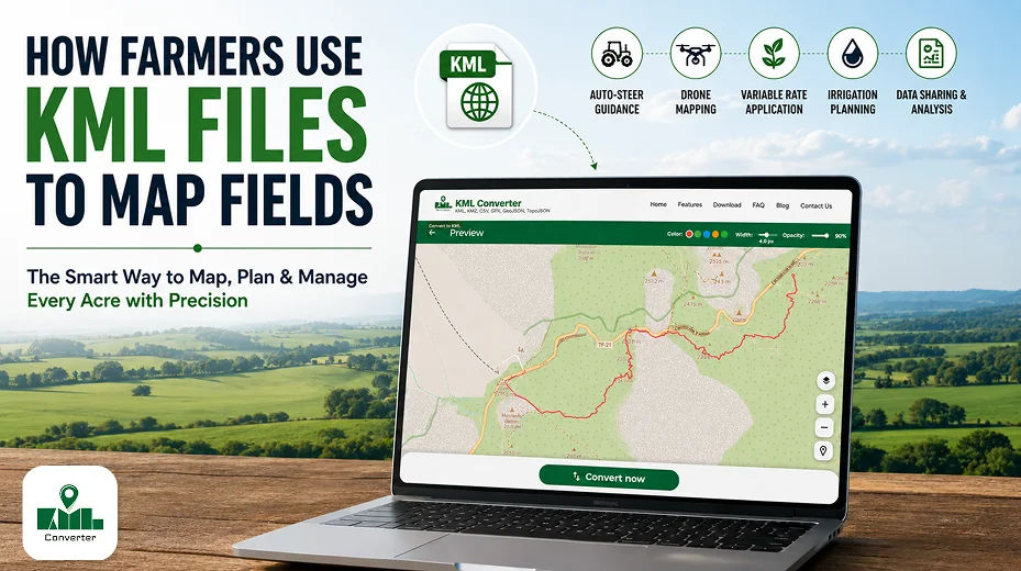
1. Tractor Auto-Steer and Guidance Boundaries
Auto-steer systems depend on clean outer boundaries to calculate headlands and pass patterns. Importing a crisp KML polygon prevents tractor operators from overlap-tilling into fence lines, utility poles, or conservation buffer strips.
2. Variable Rate Application (VRA) Maps
Agronomists divide fields into yield zones based on soil EC (electrical conductivity) or historical satellite imagery. Exporting these management zones as multi-polygon KML files allows smart spreaders to alter nitrogen or lime rates dynamically as the machine travels across zone lines.
3. Drone Flight Path Planning
Agricultural drone pilots load KML files into flight planning platforms (like DroneDeploy or Pix4D) to generate automated grid patterns. The drone follows the precise perimeter recorded in the KML file, saving battery life by avoiding unnecessary flight over non-cropped land.
4. Irrigation and Tile Drainage Planning
Topographic KML files with embedded elevation profiles allow land-forming contractors to map drainage channels, tile lines, and pivot irrigation circles with high visual clarity.
Step-by-Step Guide: How to Create and Export a Farm KML File
Follow this sequence to build clean, accurate field maps using free tools.
1. Trace field boundaries in Google Earth Pro: desktop software offers greater accuracy than mobile apps.
Download and open Google Earth Pro on desktop. Navigate to your field location using GPS coordinates or rural addresses. Select the Add Polygon tool from the top toolbar, set line color to high visibility (bright yellow or orange), and click along your field edge to trace the actual working boundary.
2. Attach Attribute Metadata: Name fields systematically for machine compatibility.
Right-click your newly created polygon layer in the left sidebar and select Properties. Fill out the description box with essential data: Field ID, Farm Name, Acreage, and Crop Type. Use strict naming conventions.
3. Export as KMZ/KML: Choose the right format for your receiver.
Right-click the named polygon under your Places menu, click Save Place As..., and choose KML (or KMZ if you have multiple layers bundled together) from the drop-down menu. Save the file to an organised cloud drive or USB memory stick.
4. Validate Coordinates in GIS or Ag Portal: Ensure the WGS84 datum projection is maintained.
Upload your generated KML into a free viewer like QGIS or your farm management platform (e.g., John Deere Operations Center). Verify that field area measurements match your land deeds within an acceptable tolerance margin (typically within 1-2%).
Benefits of Switching to KML Field Mapping
-
Precision Acreage Auditing: Eliminates disputes with custom operators or seed dealers by using calculated spatial acres rather than historical deeds.
-
Reduced Input Overlap: Integrates directly with sprayer section controls to shut off nozzles the moment a boundary is breached.
-
Simplified Regulatory Compliance: Makes reporting field boundaries to crop insurance providers or government ag agencies straightforward.
-
Seamless Team Onboarding: Allows temporary hired hands or seasonal operators to navigate unfamiliar fields using offline smartphone GPS apps by loading your master KML file.
Essential Features of Agricultural KML Files
When building KML mapping files for farm management technology, high-performing datasets share specific structural traits:
-
Polygon Boundaries: Closed loops denoting tilled or planted land, separate from wooded areas or homesteads.
-
Point Waypoints: Specific latitude/longitude markers highlighting hazards like exposed rock piles, standpipes, tile outlets, and tree stumps.
-
Line Strings: Path lines mapping farm roads, drainage ditches, terrace crests, or underground irrigation mainlines.
-
Style Tags: Custom colour codes assigned to specific crops (e.g., green for corn, yellow for soybeans) to make visual field checks instantly readable.
Real-World Field Examples
Example A: Commercial Row-Crop Operation (Corn & Soybeans)
A 3,500-acre operation in Illinois uses a single master KMZ file containing 28 separate field polygons. Every field polygon carries attributes for soil type, historical yield averages, and tile layout notes. When hiring custom chemical applicators, the farm owner emails the KMZ file directly to the operator's tablet. The operator imports it into their guidance display, guaranteeing zero chemical drift over property lines or into neighboring organic crops.
Example B: High-Value Vineyard Management
A vineyard manager in California's Napa Valley utilises multi-layer KML files created via drone multispectral scans. Each block of vines is isolated as an individual KML polygon color-coded by NDVI (Normalized Difference Vegetation Index) health ratings. Irrigation crews view these KML files on mobile tablets in the field to locate stressed vine blocks instantly and adjust drip emitter flow rates.
KML vs. Shapefile (SHP) Comparison
While spatial mapping has relied on ESRI Shapefiles for decades, modern field operations increasingly favor KML/KMZ files for everyday mobile and cross-platform use.
| Feature / Attribute | KML / KMZ Format | ESRI Shapefile (.SHP) |
| File Structure | Single XML file (or compressed zip) | Cluster of 3 to 8 separate files (.shp, .dbf, .shx) |
| Native Viewing Platform | Google Earth, Web Browsers, Mobile Apps | Desktop GIS Software (ArcGIS, QGIS) |
| Ease of Sharing | High (Small file size, single attachment) | Moderate (Requires zip bundling of all sub-files) |
| In-Cab Monitor Support | Universal import on modern displays | Universal import on traditional agricultural GIS |
| 3D Topography Support | Native elevation rendering built-in | Requires specialized 3D extension files |
| Attribute Table Depth | Basic to Moderate HTML metadata | Deep relational database attributes |
Best Practices for Clean Geographic Data
To avoid guidance errors or corrupted uploads on in-cab displays:
-
Keep Polygons Clean: Avoid overlapping lines where two fields meet along a fence line. Snapping nodes together ensures seamless borders without double-counting acreage.
-
Filter Out Non-Buildable Land: Exclude residential yards, permanent ponds, heavily wooded ravines, and wide drainage ditches from your primary cropping polygon.
-
Standardise File Names: Avoid special characters like ' or '
%in file titles or polygon labels. Stick to standard letters, numbers, and underscores. -
Use the Correct Datum: Always verify your export tools use the WGS 84 (EPSG: 4326) coordinate reference system, the global standard for standard GPS hardware and KML files.
Common Mistakes to Avoid
Warning: Small spatial errors during setup compound into expensive real-world mistakes when operating wide machinery.
-
Tracing Satellite Images Without Ground Verification: Satellite imagery on mapping portals can occasionally shift by 3 to 10 feet due to perspective tilt. Always cross-reference boundaries with actual tractor GPS logs or RTK ground points.
-
Creating Unreasonably Complex Polygons: Placing thousands of vector points along a field edge creates bloated files that slow down older tractor monitors. Keep node counts clean and reasonable without sacrificing shape fidelity.
-
Forgetting Obstacle Layers: Mapping only the field perimeter while omitting internal hazards like power pole guy wires or exposed wellheads risks machinery damage during night operations.
Expert Tips for Field Operations
-
Tip 1: Store Master Files in Cloud Repositories. Maintain a primary "Master Farm Map" folder in OneDrive, Google Drive, or Dropbox. Never edit original master files directly on terminal displays; make copies for seasonal use.
-
Tip 2: Pair KML Boundaries with RTK GPS Corrective Signals. While a basic KML drawn on satellite imagery gets you within a few feet, pairing your digital field maps with Real-Time Kinematic (RTK) network signals delivers sub-inch repeatable accuracy year after year.
-
Tip 3: Convert Old Shapefiles to KML for Mobile Field Workers. If your agronomist provides prescription maps in
.SHPthe format, convert them using free converters like QGIS or Mapshaper so farm workers can view them on basic mobile phones using Google Maps or Maps. me.
Conclusion
Understanding how farmers are using KML files to map fields bridges the gap between complex spatial analysis and practical day-to-day farming. As precision farming technology, variable-rate machinery, and autonomous drones become standard across agricultural operations, lightweight, open formats like KML keep your farm data accessible, shareable, and actionable.
By establishing digital boundaries today using free, widely available mapping tools, you reduce input waste, streamline communications with agronomists and operators, and prepare your farm for the next generation of automated agricultural technology.