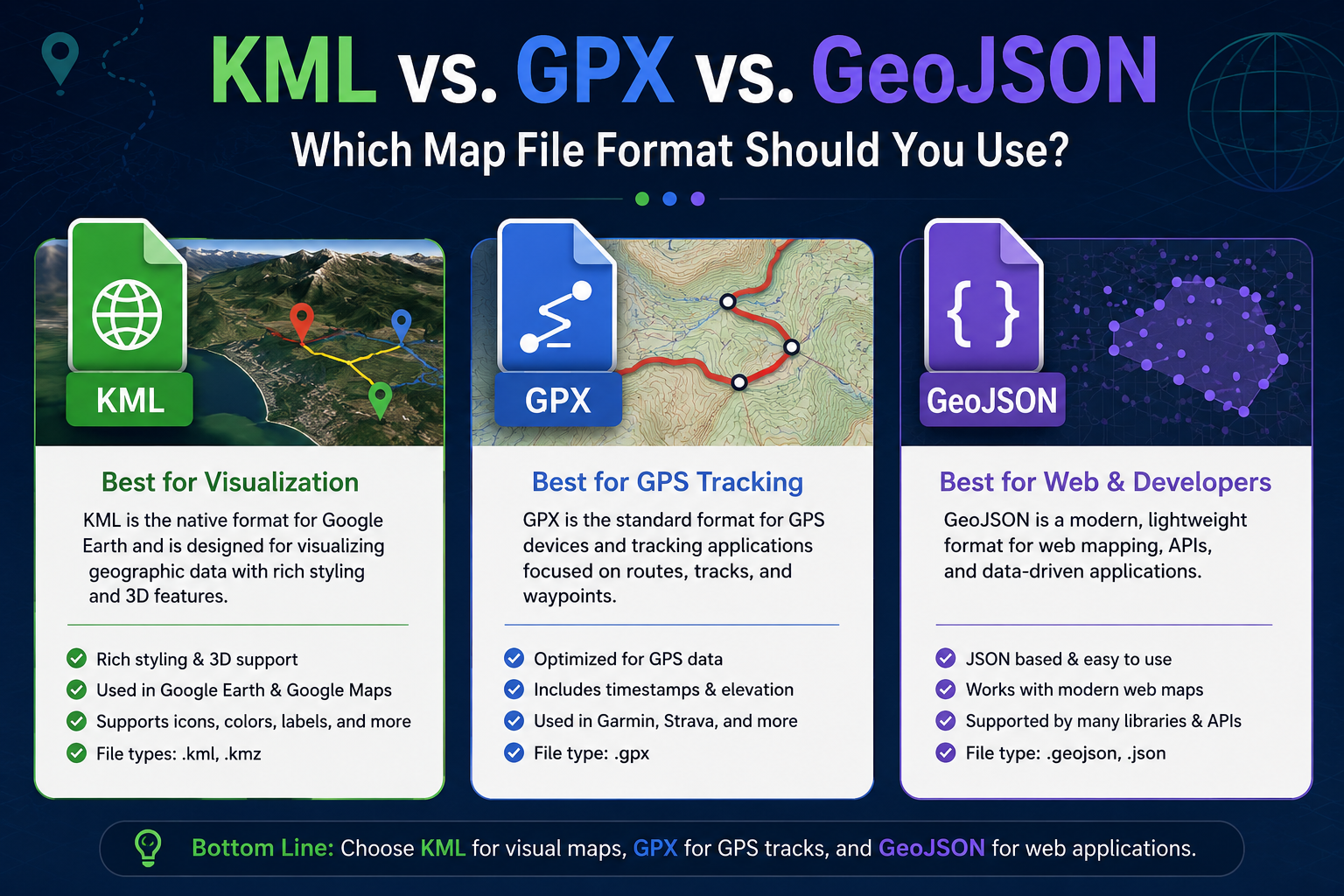
If you have ever tried to export data from a GPS device, build a web map, or load geographic data into software like Google Earth, you have likely run into a confusing alphabet soup of file extensions. .kml, .gpx, and .geojson are three of the most widely used formats for handling spatial data, but they were built for entirely different eras and purposes.
Choosing the wrong format can cause a headache. You might end up losing your styling, corrupting your data, or finding out that your web application cannot parse the file.
Let's break down exactly what KML, GPX, and GeoJSON are, how they differ, and how to choose the right one for your mapping project.
1. KML (Keyhole Markup Language)
Originally developed by Keyhole Inc. (a company Google acquired in 2004), KML is the native format for Google Earth. It is built on XML (Extensible Markup Language), which means it uses nested tags to structure data.
KML is unique because it handles both geographic data and visual styling simultaneously. It doesn't just store a coordinate; it stores the color of the pin, the angle of the map view, and 3D polygon extrusions.
-
Primary Use Case: 3D earth visualization, drone flight planning, and interactive maps in Google Earth or Google Maps.
-
Common Extensions: .kml (plain text) and .kmz (a zipped version that compresses the KML file along with any images used for custom icons).
Key Advantages of KML:
-
Rich Styling Support: Stores complex visuals, including custom colors, icons, line weights, and 3D terrain attributes.
-
Highly Compressed Options: The .kmz format drastically reduces file size, making it easy to share large datasets via email.
-
User-Friendly: Opens natively in consumer-friendly apps like Google Earth without requiring specialized coding skills.
2. GPX (GPS Exchange Format)
As the name implies, GPX is the universal language of GPS devices and fitness trackers. Created in 2002, it is also an XML-based format, but it is explicitly structured around consumer tracking workflows.
Instead of focusing on aesthetics or complex database styling, GPX focuses entirely on time, elevation, and movement. It relies on three core building blocks: waypoints (individual points of interest), routes (ordered series of points leading to a destination), and tracks (a recorded breadcrumb trail of where a device has actually been).
-
Primary Use Case: Outdoor navigation, hiking, cycling analytics, fitness tracking apps (like Strava or Garmin Connect), and hardware GPS units.
-
Common Extension: .gpx
Key Advantages of GPX:
-
Time & Elevation Awareness: Natively supports timestamps and elevation tags, which are essential for calculating speed, pace, and vertical climb.
-
Universal Hardware Support: Almost every GPS unit from a Garmin bike computer to a handheld marine navigator can read and write GPX files.
-
Lightweight Data: Strips away the overhead of custom styles, focusing purely on spatial and temporal metrics.
3. GeoJSON (Geographic JSON)
Released as a formal specification in 2008, GeoJSON is the modern standard for web development and GIS scripting. It is based on JavaScript Object Notation (JSON), making it lightweight, human-readable, and natively compatible with modern web browsers and APIs.
Unlike KML and GPX, which lean heavily on older XML structures, GeoJSON structures its spatial data into straightforward keys and values. It supports geographic primitives like Point, LineString, Polygon, MultiPoint, and GeometryCollection.
-
Primary Use Case: Web mapping applications, custom dashboards, database storage (like MongoDB or PostgreSQL), and modern GIS data pipelines.
-
Common Extension: .geojson (sometimes saved simply as .json).
Key Advantages of GeoJSON:
-
Developer Friendly: No parsing libraries are required in JavaScript; web applications can ingest GeoJSON data directly out of the box.
-
Flexible Attributes: The properties object allows developers to nest highly custom metadata alongside coordinates without breaking the file structure.
-
Highly Scalable: Integrates perfectly with GitHub, modern web servers, and cloud-native databases.
KML vs GPX vs GeoJSON: Side-by-Side Comparison
To quickly understand how these three mapping file formats stack up against one another, look at the core architectural differences below:
| Feature / Attribute | KML / KMZ | GPX | GeoJSON |
|---|---|---|---|
| Underlying Structure | XML (Extensible Markup Language) | XML (Extensible Markup Language) | JSON (JavaScript Object Notation) |
| Primary Focus | 3D Visualization & Map Styling | GPS Tracking & Navigation | Web App Integration & Databases |
| Timestamps & Elevation | Supported but not mandatory | Native and strictly structured | Supported as optional coordinate values |
| Visual Styling Capabilities | Excellent (embedded styles, 3D polygons) | Minimal (limited to basic text/tags) | Separate (requires external CSS/JS frameworks) |
| Human Readability | Moderate (verbose XML tags) | Moderate (highly structured XML) | Excellent (clean key-value pairs) |
| Best Ecosystem | Google Earth, ArcGIS, QGIS | Garmin, Strava, OpenStreetMap | Mapbox, Leaflet, PostGIS, Web APIs |
How to Choose the Best Map Format for Your Project
There is no single "best" format; the choice entirely depends on where the data is going to live and who is going to view it.
Choose KML if:
-
You are building a presentation or a visual asset meant to be viewed inside Google Earth Pro or Google Maps.
-
You need your data points to look exactly the same across different machines, retaining custom icon colors, fonts, and line definitions.
-
You are working with drones or 3D mapping software that requires elevation layers extruded into physical shapes.
Choose GPX if:
-
You are dealing with physical movement over time. If you need to map a running route, analyze a cycling workout, or plan a backcountry hiking trail, GPX is mandatory.
-
Your destination is a dedicated hardware GPS unit or a mobile navigation app like Gaia GPS or Komoot.
-
You need to extract raw speed, elevation profiles, or specific waypoint coordinates from a past outdoor excursion.
Choose GeoJSON if:
-
You are building a custom web application using mapping libraries like Leaflet, Mapbox GL JS, or OpenLayers.
-
You are storing geographic attributes inside a NoSQL database or pulling geographic data dynamically from an API.
-
You are a data analyst or software engineer scripting automated pipelines in Python, R, or Node.js where JSON handling is native and lightning-fast.
Converting Between Formats
What happens if you have a .gpx file from a bike ride but your client wants a .kml to look at in Google Earth?
Fortunately, spatial data is highly convertible. Free desktop software like QGIS can open any of these formats and export them to another with a simple right-click. If you prefer a quick web-based solution, free open-source utilities like MyGeodata Converter or Geojson.io let you drag, drop, inspect, and instantly translate your spatial files into the exact extension your project demands.