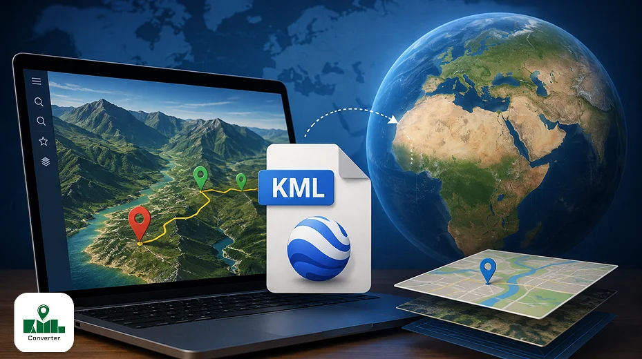
If you work with maps, GPS data, land boundaries, routes, surveying information, or geographic locations, you may have come across a file ending in . KML.
But what exactly is a KML file? How does it work, and how can you open or convert one?
A KML file is a geographic data file used to describe locations, routes, boundaries, shapes, and other information that can be displayed on a digital map. KML stands for Keyhole Markup Language and uses XML-based structures to organise geographic information.
KML files are widely used with mapping and geographic applications, making them useful for GIS professionals, surveyors, engineers, researchers, travellers, businesses, and anyone working with location-based data.
In this guide, you'll learn what a KML file is, what it contains, how to open and view it, and how you can convert KML into other popular geographic formats.
What Is a KML File?
A KML file is a geographic data file that stores location-based information in an XML format.
A KML file can contain different types of geographic objects, including the following:
- Points and location markers
- Routes and paths
- Lines
- Polygons and boundaries
- Folders and collections of locations
- Map overlays
- Descriptive information
- Styles and colors
- Geographic coordinates
- Time-related information
Because KML is based on XML, its underlying structure can also be viewed as text. However, opening the file in a mapping application is usually much more useful because the geographic information can be displayed visually on a map.
For example, a KML file might contain the boundary of a property, a hiking route, a collection of business locations, or a series of survey points.
What Does KML Stand For?
KML stands for Keyhole Markup Language.
The format was originally developed for geographic visualisation and became closely associated with Google Earth. KML later became an international standard maintained by the Open Geospatial Consortium (OGC).
KML is designed primarily to describe geographic information for visualisation. It can define not only where an object is located, but also how that object should appear on a map.
What Can a KML File Contain?
One of the reasons KML is useful is that a single file can contain different types of geographic information.
Points
Points represent individual locations using geographic coordinates.
For example:
- Survey locations
- Buildings
- Landmarks
- Business locations
- Field inspection points
Lines and Routes
KML can represent paths and routes by connecting multiple geographic coordinates.
These can be useful for:
- Roads
- Hiking trails
- Survey routes
- Property access paths
- Transportation routes
Polygons
Polygons are useful when you need to represent an area rather than a single location.
Examples include:
- Property boundaries
- Agricultural fields
- Construction areas
- Land parcels
- Geographic regions
Map Overlays
KML can also be used with geographic overlays and visual elements that appear on top of a map.
Styles
KML supports styling information such as line colours, polygon appearance, icons, labels, and other visual properties.
This makes KML useful not only for storing geographic coordinates but also for presenting them clearly on a map.
How Does a KML File Work?
KML stores geographic information using XML-based elements.
For example, a basic KML file may define a placemark containing a name and geographic coordinates. Mapping software reads these elements and converts them into visual objects on a map.
A simplified KML structure might contain:
  Example Location

    72.123,22.456,0
You don't normally need to edit this code manually. Mapping software and KML viewer applications can interpret the information and display it visually.
How to Open a KML File
There are several ways to open a KML file, depending on what you want to do with it.
Open a KML File in Google Earth
Google Earth is one of the most well-known applications for viewing KML files.
You can import a KML file into Google Earth and view its points, routes, boundaries, and other geographic information on a map.
This is particularly useful when you want to visually explore the geographic data.
Open a KML File in GIS Software
Professional GIS applications can also work with KML files.
Depending on the software, you can import KML data and use it alongside other geographic datasets for analysis, mapping, editing, and visualisation.
Open a KML File with a KML Viewer
A dedicated KML viewer can be useful when you simply want to open and inspect geographic data without working through a complex GIS application.
With KML Viewer & Converter, you can open spatial map files and explore their geographic information through different map views.
You can switch between:
- Default
- Satellite
- Terrain
- Hybrid
Different map views can make it easier to understand routes, locations, and surrounding geographic features.
How to View KML Data on a Map
Opening a KML file is only the first step. The real value comes from being able to understand the geographic information visually.
With KML Viewer & Converter, you can explore map data and inspect individual location markers.
For example, you can tap a pin along a route to inspect its location information and identify place names or map markers.
This can be useful when working with:
- Survey data
- Property locations
- Routes
- Field mapping
- Geographic points
- Travel routes
- Location datasets
Different map layers can also help you understand the same geographic data from different perspectives.
How to Convert a KML File
Sometimes KML is not the format you need for your next task.
You may need to convert your geographic data into another format for GPS applications, GIS software, spreadsheets, web mapping, or data processing.
Common KML conversions include:
- KML to KMZ
- KML to GPX
- KML to GeoJSON
- KML to TopoJSON
- KML to CSV
A KML converter can make this process much easier than manually extracting coordinates or editing XML data.
KML to KMZ
KMZ is a compressed package commonly used with KML data.
Converting KML to KMZ can be useful when you want to package geographic information and associated resources into a more compact file.
KML to GPX
GPX is widely used for GPS-related data.
Converting KML to GPX can be useful when you want to move route or track information into applications or devices that support GPX.
KML to GeoJSON
GeoJSON is commonly used in modern web mapping and geographic applications.
KML to GeoJSON conversion can be useful when geographic data needs to be used in web-based mapping systems or applications that work with JSON-based geographic data.
KML to TopoJSON
TopoJSON is another geographic data format commonly used in web development and data visualisation.
Converting KML to TopoJSON can be useful when geographic information needs to be optimised for certain web mapping and visualisation workflows.
KML to CSV
CSV is a simple tabular format that can be opened in spreadsheet applications.
Converting KML to CSV can make geographic coordinates easier to inspect, organise, filter, or analyse in a spreadsheet.
This can be particularly useful when your KML file contains multiple location points.
View and Convert KML Files with KML Viewer & Converter
If you regularly work with geographic files, KML Viewer & Converter provides tools for viewing, managing, and converting your spatial data.
You can open your map files, explore geographic information, change map views, and convert files into different formats.
Explore Different Map Views
Choose between default, satellite, terrain, and hybrid map views depending on how you want to understand your geographic data.
Inspect Locations and Routes
Tap map pins along a route to inspect location markers and place information.
Convert Multiple Geographic Formats
Convert your files into formats such as:
- KMZ
- GPX
- GeoJSON
- TopoJSON
- CSV
This allows you to use the same geographic information across different mapping and data workflows.
Organize Your Files
Managing multiple map files can become difficult over time.
KML Viewer & Converter lets you use file options to
- Share files
- Delete files
- Star important files
Starred files can then be accessed quickly from the Favourites section.
Customize Map Routes
You can also customise the appearance of map routes by selecting different line colours.
Your route styling can update across the available map layers, giving you more control over how your geographic information appears.
Manage App Preferences
The settings section provides additional options such as language preferences and purchase restoration.
These features make it easier to manage your files and customise your mapping experience.
KML vs KMZ: What's the Difference?
KML and KMZ are closely related, but they are not exactly the same.
| Feature | KML | KMZ |
|---|---|---|
| File extension | .kml | .kmz |
| Basic format | XML-based | Compressed package |
| Readable as text | Yes | Not directly |
| Geographic information | Yes | Yes |
| Can package related resources | Limited/referenced | Yes |
| Common use | Geographic data | Packaged geographic projects |
In simple terms, KML is the geographic markup file, while KMZ is a compressed package that can contain KML and related resources.
Can You Open a KML File in Excel?
KML is not designed to be opened directly as a normal spreadsheet.
Because KML uses XML, its text structure can be inspected with a text editor, but that does not provide the most convenient way to work with geographic coordinates.
If your goal is to analyse location data in a spreadsheet, converting KML to CSV is usually a more practical approach.
Can You Open a KML File on a Phone?
Yes. A dedicated mobile KML viewer can make it easier to open and explore KML files on a smartphone.
This can be especially useful for people working in the field, traveling, surveying land, checking routes, or reviewing location data away from a desktop computer.
With KML Viewer & Converter, you can view map files, switch between map layers, inspect locations, manage files, and convert geographic data directly from your device.
Common Uses of KML Files
KML files are used across many different industries and workflows.
Land Surveying
Surveyors can use KML files to visualize points, boundaries, and routes.
Agriculture
Farmers and agricultural professionals can use geographic files to represent fields, boundaries, and locations.
Construction
Construction teams can use KML data to visualise project locations, site boundaries, and geographic reference points.
GIS and Mapping
GIS professionals can use KML as part of geographic visualisation and data exchange workflows.
Travel and Navigation
KML can store routes, locations, landmarks, and points of interest for geographic visualisation.
Real Estate
Property boundaries and location information can be represented using KML polygons and placemarks.
What to Do If a KML File Won't Open
If your KML file isn't opening correctly, try these steps:
- Check what the file ends with
.kml. - Make sure the file isn't damaged or incomplete.
- Try opening it with another KML-compatible application.
- Check whether the KML contains valid geographic coordinates.
- If the file is very large, try using a dedicated KML viewer.
- If you need a different format, convert the KML into a suitable geographic file type.
If the file still doesn't work, the problem may be related to the structure or contents of the KML file rather than the .kml extension itself.
Final Thoughts
KML is a versatile format for storing and visualising geographic information. Whether you're working with property boundaries, survey points, routes, locations, or other spatial data, KML provides a practical way to organise geographic information for mapping applications.
When you need to inspect your data visually, a dedicated KML viewer can make the process easier. When you need to use the same data in another application, converting KML to formats such as KMZ, GPX, GeoJSON, TopoJSON, or CSV can make your workflow more flexible.
With KML Viewer & Converter, you can view your spatial files, explore different map layers, inspect locations, organise your files, customise route styles, and convert geographic data into formats suited to your workflow.

